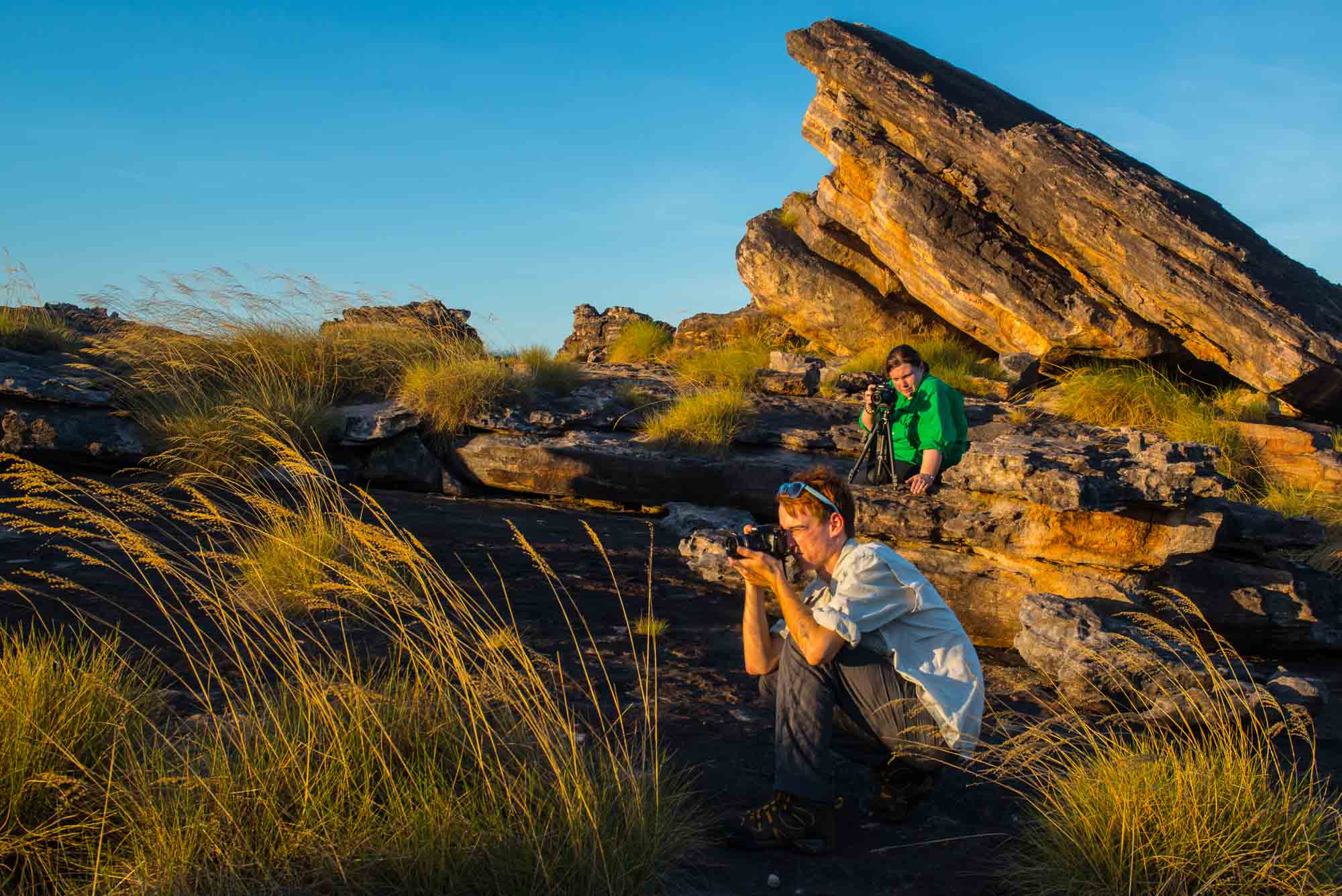
Photographing the Top End
The Top End is the name used for the northernmost part of the Territory. It encompasses beaches, mangroves and tidal creeks that are great for photography – but take mosquito repellent – then coastal plains that, during the summer monsoon season, become spectacular wetlands. From the plains rise the sandstone outliers and cliffs of the Arnhem Land Escarpment. This magnificent homeland has great significance for its indigenous occupants, and is also home to abundant wildlife.
The harmless Freshwater Crocodile and the dangerous Saltwater (or Estuarine) Crocodile are both found in the Top End wetlands and rivers. The possibility of a large “Saltie” being in residence should deter visitors from entering the water, no matter how hot the weather. Some people who have ignored signs have, as a result, met a gruesome end.
In this land of legends, the reflections that reach the outside world are often less remarkable than their originals. It is a place of dramatic contrast. The Top End in the summer Wet is quite different from the same country in the Dry.
My suggestion is to visit this area first in the cooler months, between May and August. If you can, bring or hire your own vehicle, because, for photographers, independence is important in this area – sudden stops, and sudden changes of plan are a common occurrence.
The following are sample pages from Volume 6 Part A – all linked to maps
Photographing Australia The Ultimate Travel Guide

Limmen National Park
Darwin’s consistently tropical and often steamy climate lends the city and its citizens the right to be relaxed. During the wet, the city’s parks and gardens burst with verdure and intense tropical thunderstorms light up the night. In the dry, Darwin relishes the cooler temperatures and adopts a festive air, with citizens and visitors taking to the streets to enjoy alfresco dining, outdoor entertainment, sporting events, open air markets and picnics overlooking the famously lurid sunsets.
Strolling along the walking tracks that fringe the Esplanade, Mindil Beach, East Point, and the scenic northern-suburbs foreshore is one of the best ways to absorb Darwin’s serenity. Extensive bicycle paths also criss-cross the open spaces. If you prefer a more insightful tour, try the Tour Tub, which runs on an hourly circuit through the city, visiting points of interest. Buses depart from terminals in Darwin and the northern suburb of Casuarina.
REGIONAL PHOTO TIPS
- Plan your visits at festival times, when Darwinites will be out in force.
- Top End sunsets are amazing, and part of the local culture (above) is to set up a picnic and toast the evening sky on Mindil Beach.
- While the 1974 Cyclone Tracy flattened much of Darwin, some terrific examples of tropical colonial architecture, such as Government House, remain. The Museum & Art Gallery’s sobering audio exhibit lets you experience the howling Category 4 winds.
- Day-trips to Fogg Dam to photograph waterbirds; one of several crocodile farms to learn more about crocodilians; the unmissable Territory Wildlife Park (where many of the more elusive endemic Top End species are housed); and Litchfield National Park (see following pages) are all worthy of your time.
- Another worthy photographic adventure is a visit to Bathurst Island. Known as the “Island of Smiles”, it is one of the Tiwi Islands and culture and art abound.
- Multicultural festivals invite images of costumes, theatre, and art.
- Gardens Park (bottom right) can be great for waterbirds and bush birds early and late in the day.

Nitmiluk National Park
The Katherine River snakes through Nitmiluk National Park in a series of long, deep reaches beneath magnificently coloured sandstone cliffs. This world-famous region comprises thirteen spectacular gorges (Katherine Gorge being the most famous), separated by boulder rapids. Means of exploring this park include boat cruises, canoeing, bushwalking and, spectacularly, helicopter flights. The high, jagged walls of the gorge system were slowly carved from the surrounding sandstone-conglomerate plateau by the sluicing Katherine River over millennia.
Walking tracks include riverbank strolls, overnight walks, and a five-day extended trek from Katherine Gorge to Edith Falls. Overnight walkers must register with the Parks and Wildlife Service at the Nitmiluk Centre, but can expect to see freshwater crocodiles basking on exposed rocky slabs and sandbanks and narrow canyons headed with waterfalls and brimming with palms, figs, and paperbarks.
Nitmiluk Tours operates various boat tours departing from the main boat ramp, ranging from the popular two-hour cruise of Katherine Gorge, to half-day or full-day safaris visiting several gorges. Indigenous art adorns the base of the sandstone escarpment as you travel the river, and evidence of the traditional Jawoyn owners is visible throughout the park.
REGIONAL PHOTO TIPS
• The clifftop provides the best panoramas of the river and gorge. You can take cruises or paddle a canoe (either your own or hired) in the dry season, but this is a vast river system, so prepare to do plenty of paddling. Try to schedule in at least one night to camp out upriver.
• Waterbirds and bush birds, mammals, and reptiles are all commonly encountered inhabitants here. Some animals, like the male agile wallaby (above), are so accustomed to tourists you can sit down with them for a selfie! At night, wildlife activity is rife, with plenty of possums, wallabies, and the comings and goings of flying-foxes. If you’re lucky, a brush-tailed phascogale (top) might even pay your campsite a visit.
• If you are a keen wildlife photographer and you have your own boat, this park is unbeatable and deserves an extended visit.

Kakadu National Park
Kakadu National Park covers a 19 804 km² swathe of the Top End, from Nitmiluk National Park in the south to Van Diemen Gulf in the north. It is not an overnight visit, so factor in at least three days to experience the many habitats and highlights.
Kakadu incorporates the West and East Alligator River regions and the entire catchment of the South Alligator River. Around half of Kakadu is Indigenous-owned and most of the remainder is subject to Native Title claims. Evidence within Kakadu, including some magnificent rock art, suggests Indigenous people have lived in the area continuously for more than 50 000 years. Today, the land is leased to the Director of National Parks and jointly managed with traditional owners from several language groups.
The blend of natural and cultural features within Kakadu makes it a phenomenally exciting region to visit and photograph and garnered it UNESCO World Heritage listing in 1981. Numerous education centres and Indigenous tours showcase its many wonders, and I recommend taking at least one.
Geologically, the foundation of this region is the imposing Arnhem Land Escarpment — an ancient sandstone formation that makes up one-third of Arnhem Land. This “stone country” on the eastern side of the park is home to Kakadu’s most unusual plant and animal communities.
Kakadu’s diverse habitats change substantially from season to season, so the right time to explore the park depends on what you wish to see. In Gudjewk (January to March), the wet season rains wash down the escarpment — overflowing the Alligator River and flooding the low-lying coastal plains. During Banggerreng (April) the skies clear, but violent, windy storms lash the land. As rains replenish the wetlands, countless waterbirds begin their mating rituals. By Yegge (May to mid-June), raging waterfalls have become silver arcs descending to permanent rock pools, and the waterbirds retreat from the drying plains to crowd shallow billabongs and swamps. In the drier seasons of Wurrgeng (mid-June to mid-August) and Gurrung (mid-August to mid-October), the cool shade of the monsoon forest is a refuge for species from other habitats. The humid monsoon build-up begins during Gunumeleng (mid-October to late December), and then the whole six-season cycle repeats. Such is Kakadu’s scale that even a single season presents an impressive array of wildlife and habitat to explore.
REGIONAL PHOTO TIPS
- What’s the best time to visit? It can be a challenge knowing where to start, but each season has something special to offer. If you’re on an around-Australia trip, you may have to accept the seasonality and the weather conditions of the day. Nonetheless, when I plan a trip, I try to ensure I pass through the northern regions of Australia just after the wet season has passed, simply to ensure all the roads are open and that I don’t get flooded in (or out). Of course, if you are not a fan of humidity, aim for the cooler months from June to August.

South Alligator Area (Top Row)
The very heartland of Kakadu, this area showcases all eight habitats that can be found in the park. The best time to visit is in the late dry season, from September to October.
Don’t miss the Mamukala Wetlands, a floodplain 7 km east of the river crossing that is alive with birdlife, particularly in the drier seasons. Once a traditional hunting area, it attracts more migratory magpie geese than anywhere else in Australia and features an easy 3-km circuit walk, a viewing platform, and several excellent bird hides. Close to the Aurora Kakadu Resort is the Kungarre Monsoon Forest Walk. This foliage-shaded 3.6-km trail is ideal for the hotter parts of day and the forest wildlife includes agile wallabies, orange-footed scrubfowls, and yellow-spotted monitors.
Contact the Warradjan Cultural Centre at Cooinda in Kakadu NP to take an afternoon tour onto the floodplain and see how Indigenous people traditionally lived off this bountiful land.
East Alligator Area (Centre & Bottom Rows)
This western catchment of the East Alligator River reveals a horizon of floodplains punctuated with the superb rock art site of Ubirr (bottom left) and an eastern boundary shared with Arnhem Land.
The highlight is the magnificent ancient rock art galleries at Ubirr (centre and bottom). A 1-km circular track leads to five sites featuring extensive examples of wildlife motifs, sorcery art, and Contact Period art. Rangers provide tours and talks during dry seasons. An additional 250 m moderately steep climb to the lookout is rewarded by superb 360° vistas over the Nardab floodplain and sandstone outliers to the north. These scenes are best photographed during the late afternoon and at sunset when the sky is awash with colour.
The 2.5-km Bardedjilidji Walk commences at the car park, 500 m from the upstream boat ramp, and takes you through a world of fine-layered, wonderfully coloured sandstone outliers. A second easy 1-hour stroll through monsoon forest begins near the downstream boat ramp and leads to viewing platforms along the river. I also highly recommend the boat tours available on the East Alligator River.
REGIONAL PHOTO TIPS
• This area presents a wonderful opportunity to develop your photographic storytelling skills. Consider the tourist activities part of the overall story. Visit Jabiru and collect shots from around the town. Remember, digital files are free, so take as many as you need to come away with a collection to last a lifetime. Booking an East Alligator River Cruise will introduce you to the largest estuarine (saltwater) crocodiles in the world!

Occupying the central area of the park, and with the familiar russet-sandstone bulk of Burrungkuy (Nourlangie) Rock looming from its centre, this region is primarily the Nourlangie Creek catchment. Several absorbing walks wind around Burrungkuy (Nourlangie Rock) and Anbangbang Billabong. Attractions include the many rock art galleries and the Anbangbang occupation site, which traces over 20 000 years of Indigenous culture through periods of environmental change.
A 1.5-km circular walk takes in several art sites and ends with a moderately steep walk to Kunwarddehwardde Lookout, which gives lovely of Burrungkuy. An easy 1.5-km walk from the first road on the left after leaving the car park leads to pretty Anbangbang Billabong, where you may photograph agile wallabies, yellow-spotted monitors and northern long-necked turtles. The 600-m Nawurlandja Lookout Walk is accessed off the second road after leaving the car park and gives you outstanding views of the surrounding escarpment.
Jim Jim Creek and its scenic waterfalls draw tourists from across the world. Access is by 4WD only, and 60 km along the Jim Jim Track, you will find a 2-km walking track through monsoon forest and over rocks to Jim Jim Falls plunge pool. The pool and waterfalls are ringed by 150-m high cliffs (Jim Jim Falls only flows in the wet season from December to July). A further 10 km down the road is a 2-hour walking track to Twin Falls (inset far left).
Jabiru is Kakadu’s most developed district and offers a range of services and comfortable accommodations. The beautifully styled Bowali Visitor Centre contains all the information you need for a Kakadu adventure. The Iligadjarr Walk, near the Malabanjbanjdju and Burdulba camps, is a 3.8-km circular track across a grassy floodplain to Burdulba Billabong.
Yellow Waters Region (bottom row left & right)
Magnificent wetlands are the key feature of Yellow Water in the central Kakadu National Park area. Commercial boat tours are available, enabling you glide over the South Alligator floodplain and photograph the incredible birdlife and lurking crocodiles. Having said that, I prefer to charter my own boat, which allows me to wait patiently to capture wildlife behaviour and to photograph at dawn and dusk when the animals are most alert and the reflections in the water are magnificent. The Mardugal Walk (1 km return) follows Mardugal Billabong.
REGIONAL PHOTO TIPS
- Kakadu is one of those special places that require you to remain alert and work with a couple of cameras simultaneously: one for the landscape and another with a longer lens to close focus on the birds and wallabies. I prefer to time my boat cruises during the first or last three hours of daylight when photographing the Top End.
- An Indigenous-guided tour is a necessity in Kakadu. There are several to choose from, depending on what you want to experience. Just ask at one of the information centres. You might also encounter Indigenous rangers throughout the park.

The Arnhem Escarpment
Walking tours and flights both reveal one of Australia’s most spectacular wild places. During the wet season, flights are best taken in the afternoon light or on soft overcast days, which ensure your images will capture the detail in the crevices (as illustrated above). A very steep, marked walking route leads to the plateau above Jim Jim Falls, but is suitable only for fit people who can manage a precipitous climb in steamy conditions. Allow 4 to 6 hours for this walk, and be sure to carry plenty of water.


Darwin & Surrounds
Darwin’s consistently tropical and often steamy climate lends the city and its citizens the right to be relaxed. During the wet, the city’s parks and gardens burst with verdure and intense tropical thunderstorms light up the night. In the dry, Darwin relishes the cooler temperatures and adopts a festive air, with citizens and visitors taking to the streets to enjoy alfresco dining, outdoor entertainment, sporting events, open-air markets and picnics overlooking the famously lurid sunsets.
Strolling along the walking tracks that fringe the Esplanade, Mindil Beach, East Point, and the scenic northern-suburbs foreshore is one of the best ways to absorb Darwin’s serenity. Extensive bicycle paths also criss-cross the open spaces. If you prefer a more insightful tour, try the Tour Tub, which runs on an hourly circuit through the city, visiting points of interest. Buses depart from terminals in Darwin and the northern suburb of Casuarina.
REGIONAL PHOTO TIPS
- Plan your visits at festival times, when Darwinites will be out in force.
- Top End sunsets are amazing, and part of the local culture (above) is to set up a picnic and toast the evening sky on Mindil Beach.
- While the 1974 Cyclone Tracy flattened much of Darwin, some terrific examples of tropical colonial architecture, such as Government House, remain. The Museum & Art Gallery’s sobering audio exhibit lets you experience the howling Category 4 winds.
- Day-trips to Fogg Dam to photograph waterbirds; one of several crocodile farms to learn more about crocodilians; the unmissable Territory Wildlife Park (where many of the more elusive endemic Top End species are housed); and Litchfield National Park (see following pages) are all worthy of your time.
- Another worthy photographic adventure is a visit to Bathurst Island. Known as the “Island of Smiles”, it is one of the Tiwi Islands and culture and art abound.
- Multicultural festivals invite images of costumes, theatre, and art.
- Gardens Park (bottom right) can be great for waterbirds and bush birds early and late in the day.


Fog Dam Conservation Reserve – above
The RAAF Airfield Construction Squadron built Fogg Dam in the 1950s to irrigate rice plantations for the short-lived Humpty Doo Rice Project. The dam is now a thriving wetland just a 45-minute drive from Darwin and is brimming with wildlife. Birds especially flock to this watery wonderland (particularly during the dry season), but estuarine (saltwater) crocodiles, water pythons, and various mammal species can also be photographed here. The dam wall extends some 500 m across the wetland and is an excellent vantage point for photographing wildlife. The presence of estuarine crocodiles prohibits visitors from venturing close to the water on foot and certainly from swimming. Also, take repellent, as squadrons of mosquitoes descend in the morning or late in the afternoon.
REGIONAL PHOTO TIPS
- A handful of easy, well-signposted walks reveal the best aspects of the Fogg Dam wetlands. The Woodlands to Waterlily Walk is an easy 2.2-km stroll through forest fringing the floodplain. A number of lookout points are dotted on the way to a boardwalk leading up to the dam. The 3.6-km Monsoon Forest Walk takes two hours and leads onto the floodplain through paperbark and monsoon forest.
- Due to the presence of crocodiles, visitors are advised not to walk across the dam wall, although you can park your car and access some shaded viewing platforms along the way. For a more elevated scope, try the 2.5-km Pandanus Lookout Walk — an easy 1-hour walk to a location that is especially gorgeous at sunrise and sunset. Guided walks of the area are also worth exploring.
- Pudakul Aboriginal Cultural Tours runs some tours that incorporate Fogg Dam and give visitors an understanding of the country’s importance to its traditional owners.
- Visiting at night (with torches) will uncover a different wetland world to that seen during the day.
- The tail end of the wet season, from February to April, is the best time to visit Fogg Dam and focus on wild waterbird behaviour.

Territory Wildlife Park
Both the Territory Wildlife Park, just 45 minutes south of Darwin on the Cox Peninsula Road at Berry Springs, and the Alice Springs Desert Park in the Red Centre, are owned and managed by the Northern Territory Government. When you travel the Territory, I recommend you take the opportunity to spend at least a full day in each. In both parks, captive and free-ranging animals can be easily approached for photography. Territory Wildlife Park will also give you the chance to hone your skills at photographing elusive species, some of which, like the freshwater species exhibited, can be extremely difficult to find and photograph in the wild. Not only will you see wildlife up-close in well-constructed enclosures that closely replicate natural habitat (and indeed are natural in many instances), but you can also stroll through treetop aviaries, photograph freshwater whip rays at the Oolloo Sandbar exhibit, and even interact with animals personally during presentations or wildlife encounter experiences.
REGIONAL PHOTO TIPS
- Explore the Territory Wildlife Park website for feeding times and wild encounter opportunities.
- The freshwater aquariums in this park are superb. Crocodiles prohibit underwater photography in the Top End, so these aquariums give you a sense of the submerged aquatic life. See Photographing in Aquariums in Volume1: Capturing the Essence.
- The aviaries are macro habitats with healthy, active birds so pack a telephoto lens to get detailed shots.

Litchfield National Park
Just 115 km south of Darwin, Litchfield National Park encompasses more than 146 000 ha of sandstone highland, raw-faced escarpment and lowland floodplain. Each wet season, monsoon rains swell tributaries of the Adelaide, Finniss, and Reynolds Rivers, which rumble over the Tabletop Range into rock pools and creek beds before spilling across the paperbark floodplains, providing incredible content for photography.
Litchfield is also the perfect Top End nature experience for those who prefer not to hike endless kilometres to the best waterfall, lookout, or rock formation. Its roads and trails are well-marked and magnetic termite mounds, stunning cascades, and refreshingly clear natural swimming pools are all readily accessible.
REGIONAL PHOTO TIPS
- Just inside the park border, on Litchfield Park Road, is a series of 2-m high mounds sculpted by magnetic termites (centre). These social insects have ingeniously aligned their homes in a north–south orientation to keep themselves cool.
- Florence Falls (top left), Wangi Falls (bottom left) and the other smaller, less-visited cascades are best photographed just after the wet season, although I have photographed them with good flow as late as July. Overcast days are best, preferably using a tripod and slow shutter speed to help create a sense of motion in the water.
- Designated swimming areas at Buley Rockhole and at the falls are open in the dry season after rangers have checked that there are no crocodiles. These places are also great for bird photography, and you might even see short-eared rock-wallabies as you descend the steps into Florence Falls. These normally shy animals have become accustomed to passing tourists, but they blend well with the sandstone, so you will have to look carefully.
- Litchfield also has its own Lost City – a Labyrinthine collection of sandstone stacks that are worth a visit, especially if you haven’t had time to visit Limmen National Park.

Judbarra/Gregory River National Park
A highlight of the journey to Kununurra, this region is well worth visiting even if you do not intend to continue beyond the border. Judbarra/Gregory National Park is divided into an eastern section around Victoria River Roadhouse and a western section south of Timber Creek.
EASTERN SECTION REGIONAL PHOTO TIPS
- Enjoy excellent views of the Victoria River and its surrounding escarpment from a 3-km return walk starting at the highway some 2 km west of Victoria River Roadhouse. You can avoid the steeper sections by walking only to Garrarnawun Lookout and return, a1-km, easy walk.
- At Joe Creek picnic area, 10 km west of Victoria River Roadhouse, a relatively difficult 1.7-km track climbs to an Indigenous art site with brilliant vistas of the escarpment. If you want the views without the effort, stop at the Kuwang Lookout further up the Victoria Highway.
- From Kuwang Lookout, 57 km to the west of Victoria River, you receive excellent views of the Stokes Range as well as interpretative displays relating the Indigenous history of the region.
WESTERN SECTION REGIONAL PHOTO TIPS
- Many interesting historical sites, geological features, and walking opportunities are to be had in the western section of Judbarra. Visit Gregory’s Tree, tour (and photograph) the stromatolite formations of Limestone Gorge or explore the historic Bullita Homestead.
- The township of Timber Creek, once a river port servicing the pastoral stations, is now a supply centre with extensive facilities for tourists and local communities. This is where my crew and I were stuck for seven days with flooded roads!
- Gregory’s Tree is an easy 500-m return walk from the road. The tree is surrounded by a boardwalk and there are views of the Victoria River as well as information on Gregory’s expedition.
- From Limestone Gorge campground you can swim in Limestone Creek Billabong or enjoy spectacular views of the East Baines River valley on the1.8-km moderately easy Limestone Ridge Loop Walk.
- Two kilometres before the campground, the 600-m return Calcite Flow Walk gives you impressive views of the nearby limestone formations.

Keep River National Park
Heading south from the Top End into Western Australia, Keep River National Park is just before the Western Australian border. Volcanic activity here has left its chaotic design in a series of eye-catching, striated sandstone formations and natural arches, making this park an excellent location for photography. Home to the Miriwoong and Gajirrabeng people for thousands of years, Keep River has plenty of Indigenous rock art sites (bottom left) and also features stone middens and a traditional bird hide for hunting hawks.
REGIONAL PHOTO TIPS
- The 200-m Ginger’s Hill Walk is notable for the Indigenous stone structure on the hill. Some of the park’s superb sandstone formations can be seen on a 2-km walk that starts at the Goorrandalng campground.
- The Jenemoom Walk leads you down the Keep River to a former wet season hideaway of the Miriwoong people.
- From the Jarnem campground, a complete loop takes in rock art sites and an excellent lookout.
- As the name implies, Cockatoo Lagoon is a good place to photograph some of Australia’s more raucous species and is a wonderful place for a morning photo walk.
The video is a clip from Part One of the Northern Territory